For more information, contact:
Glen Jones
403.651.3086 or glenj@didigeodata.com
Dan Subtelny
647.285.5636 or dans@digigeodata.com
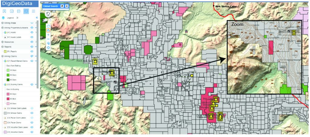
This powerful online GIS interactive mapping interface spatially links and displays data from DigiGeoMaps and DigiGeoData.
Data can be turned of or on from layers at different zooms levels.
Functionality includes zoom, pan, query, search, markup, printing and exporting in Shape and CSV formats.
One of the highlights of DigiGeoAtlas is the ability to interrogate Canadian claim data seamlessly across Canada. Claims (leases and permits) from all Canadian provinces and territories are compiled with common fields.
A significant value add are the two layers that show both recently staked claims and claims that will be expiring in the next 30, 60 and 90 days. This is extremely valuable for monitoring activity within areas of interest.
With continuous innovation and development, DGDs business concept is to optimize technology that can support decision making, effectively enhance the quality of data and provide innovative solutions from market demands.
Data Layers & Functionality
Basic tools View only |
Full suite of tools Downloads |
|
| Functionality | ||
| Bookmarks: existing | ||
| Bookmarks; create new | ||
| Export Shape | ||
| Export data to CSV | ||
| Feature Search | ||
| Global Search | ||
| Highlight | ||
| Identify | ||
| Measure | ||
| Redline/Markup | ||
| Symbology Edit | ||
| Detailed Map Areas | ||
| Mineral Claims | ||
| Placer Claims | ||
| Industrial Claims | ||
| Topo Layers | ||
| DEM (Digital Elevation Model) - Detailed Area Maps | ||
| Roads | ||
| Populated Places | ||
| Townships | ||
| State/Provinces | ||
| Claim Data Full Access | ||
| Recent Staked Claims | ||
| Expiring Claims | ||
| Mineral Claims | ||
| Placer Claims | ||
| Industrial Claims | ||
| Reports | ||
| Reports: 43-101 reports for past 10 years | ||
| Property & Assets | ||
| Assets: Mines, Deposits and Zones | ||
| Resources: Major Commodities, regular updates | ||
| Production: Major Commodities, regular updates | ||
| Geology | ||
| Geology Layer (Uncoloured) | ||
| Fault lines | ||
| Additional Features | ||
| Corporate and multi user rates | ||
| Coming Soon | ||
| International Claims | ||
| International Assets, Resources and Production |
DigiGeoAtlas is a yearly subscription tool with access to a full GIS interactive mapping application. All data is updated on a regular basis including Canadian claims (leases and permits), mines, deposits, zones, resources, production and reports.
