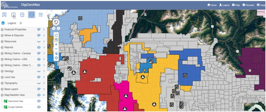
DigiGeoAtlas is an interactive spatial mapping tool that delivers a content rich visual environment that helps you monitor crucial changes to mineral claims & leases, properties, and assets within North America with a focus on Canada.

Atlas displays layers of key project information in one easy-access high resolution platform. Technical data such as leases and claims, infrastructure, mines, deposits, zones, resources, technical reports, drill holes and geology may be overlain to assist analysis for comprehensive and informed decision making.
Affordable, Contextual, Interactive, Practical, and Efficient
Easy to use and interrogate
Markup and print maps to PDF, JPG, PNG
Individual layers for resources
5 Search types across many layers
WMS and WFS compatible
Download data to Excel or ESRI (shape) format
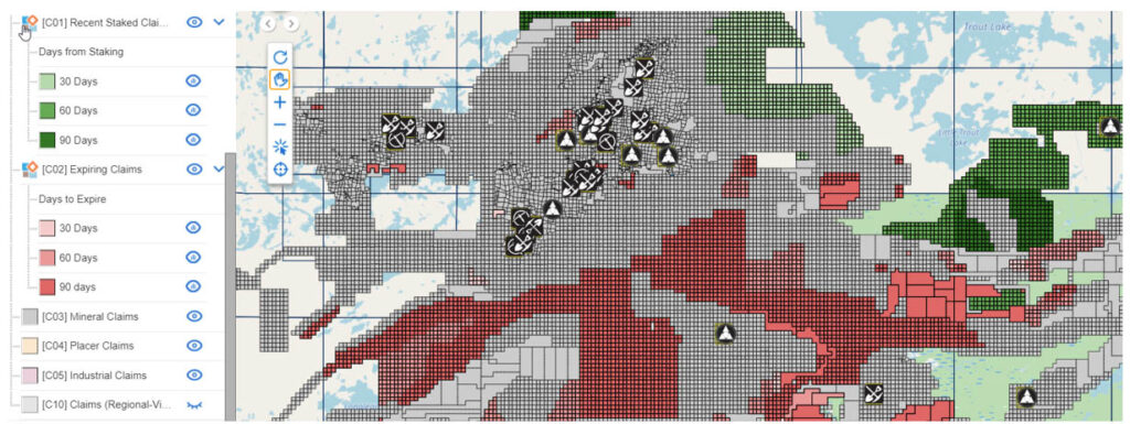
Monitor Claim Activity with a 365 Day Staking Window
View claims that have been staked within the last year in 30, 60, 90, 180 and 365 day increments
Monitor claims that will be expiring with the next 30, 60, 90, 180 and 365 day increments

Why Use DigiGeoAtlas
- Monitor claim activity
- Monitor distinct areas of exploration such as Red Lake
- Monitor competitor activity
- Business development and screen acquisition targets
- Basic land management
Why Use DigiGeoAtlas
- Canadian claim compilation – now updated weekly, progression to daily
- United States BLM data where available, currently 11 jurisdictions
- Recently staked and expiring claims – 30-60-90-180-365 day windows
- Client layers – clients can load data onto our server to a secure layer
- Upload searches to temporary layers
- Mineralization style
- Compiled property layer
- Property linking to company website
- Tagging data by area, i.e., Red Lake: resources, reports, properties, assets
- Complete Exploration
- Area Compilation, i.e., Red Lake:
- Historical deposits with resources
- Historical Mines