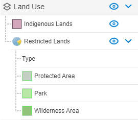
DigiGeoData announces the addition of two new data layers, Google Satellite and Restricted Lands, to DigiGeoAtlas.
Google Satellite

Google Satellite is available in any zoom level and it can be turned on/off to toggle between satellite and map views. It is a great addition to identify ground surface features precisely and to compare with other GIS data layers on DigiGeoAtlas including mining-claims, properties, mines and deposits.
Restricted Lands

For a demo on how to use these layers, contact
Dan Subtelny – 647.285.5636; dans@digigeodata.com
Glen Jones – 403.651.3086; glenj@digigeodata.com