September 2019
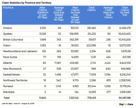
As of August 31, 2019, Canada had approximately 94.6 million hectares of lands granted for mining and exploration by the provinces and territories. Just over 1.5 million hectares of these lands were added in the last 90 days.
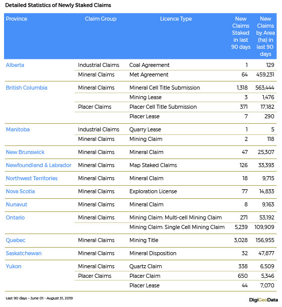
Ontario, Quebec, British Columbia and Yukon were the 4 most active provinces and territory in the last 90 days adding 11,269 newly staked claims covering 0.9 million hectares of lands. These 4 provinces have a combined total of 42% of the lands by area (39.7 million hectares) or 92% of the claims by count (717,727 claims) of the total.
As claim size varies with claim type and jurisdiction, the average claim size is calculated for each province in the last 3 months
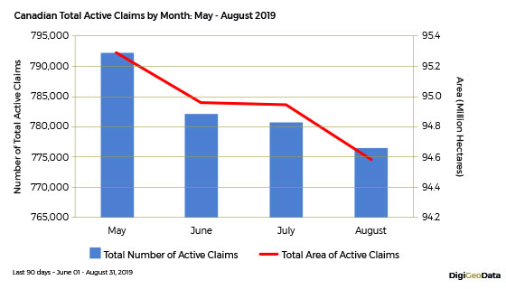
The following chart compares the change in the monthly total active claims by number and by area over the last four months. These statistics indicated a slight decrease of approximately 2% of total active mining claims over the past four months.
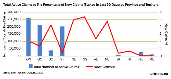
The chart below compares the total active claims by province and terrritory and the percentage of new claims staked in the last 90 days. British Columbia shows over 4% of newly stakes claims indicating some staking rush in the province.
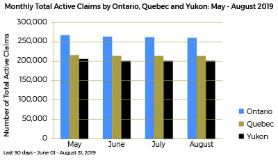
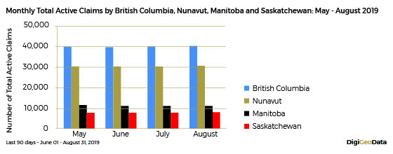
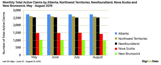
The following three bar charts compare the provincial monthly number of total active claims. The analysis shows that the provincial claim staking was relatively stable in the last four months in general when combining reported new claim staking and expired claim dropping.
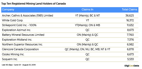
The chart below summarizes top ten registered land holders in Canada as of August 31, 2019 according to government websites. Only claims with 100% ownership were considered in the analysis.
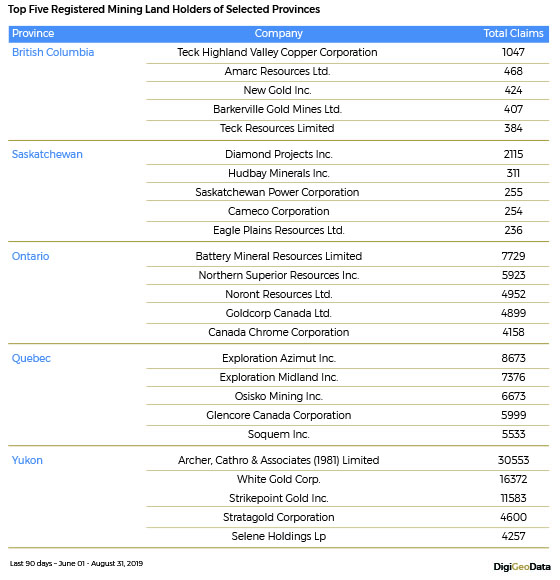
The table below summarizes the top five registered land holders in selected provinces as of August 31, 2019 according to government websites.
The chart below summarizes top ten registered land holders in Canada as of August 31, 2019 according to government websites. Only claims with 100% ownership were considered in the analysis.
