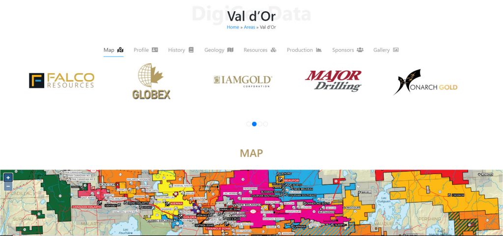
DigiGeoData announces the launch of new website functionality in response to feedback from our map sponsors and users. During these unusual times, many conferences have been cancelled and interaction between companies and investors is limited. Most people are working from home and are using online research. The addition of these maps helps users to access maps they have not been able to find to date. Service and supply companies demonstrate their availability for the map area and encourage companies to reach out for more detailed information.
Each of the published maps are now available for viewing on the map area profile page. Users can zoom in and out and pan to view company properties, mines, and deposits.
Click on the link to starting using.

Logos for companies that sponsor the map scroll across the top providing more visibility for the sponsors. Clicking on the logo takes the user to the company profile that includes website link, trading symbol if applicable and information about properties or services.
Another added benefit will be the addition of maps that are being compiled to be published in the future. Sponsors will have the added benefit of a longer exposure time as their properties and services will be shown as the map is built.
Users who want more detailed information for each map area are encouraged to use Atlas, our interactive mapping interface, by clicking on this link.
For more information, inquiries about map sponsorship or suggestions for future maps, contact
Dan Subtelny – 647.285.5636; dans@digigeodata.com
Glen Jones – 403.651.3086; glenj@digigeodata.com