Red Lake Mining Camp Exploration History
Red Lake was originally the site of a Hudson’s Bay Co fur-trading post (1790-1822). From the mid -1870s to the early 1920s, the quest for furs, then for minerals, brought people to the area.
Survey work in the area was first carried out by the Geological Survey of Canada in 1883. Gold was originally reported in the Red Lake area in 1897 by R.J. Gilbert who eventually staked claims.
In 1924, two years after a discovery of gold by Gus McManus, the Ontario Department of Mines published a geological report on this district. The remoteness of the region prevented serious exploration activity until 1925 when claims were registered by Ray and Lorne Howey and George McNeely. These claims eventually became part of the Howey Mine. This was the catalyst of a major gold rush to the area.
More than 3,000 people converged on Red Lake at the height of the Gold Rush of 1926. They traveled by dog team or by foot on the frozen rivers and lakes, over the 180-mile gold rush trail. In spring, they used canoes or small boats, and before long, airplanes. Eventually the bush plane came to dominate travel. In 1936, Howey Bay, in the heart of Red Lake, was the busiest airport in the world, as aircraft of all shapes and sizes transported freight and passengers in and out of the area at 15-minute intervals.
The first recorded production from the Red Lake area came from the Howey Mine. The mine produced 452,000 ounces of gold until the mine was closed in 1957.
During the1930s and 1940s production peaked with 12 producing mines.

There were other mines that had smaller and limited production during that time.
Gold mining declined during the next 2 decades until 3 new mines opened during the 1960’s. They were the H.G. Young, Annco and Willmar producing an aggregate of 161,000 ounces of gold until the last one closed in the 1970s.
Two of the most prolific mines which started producing in the 1940s, the Campbell and Red Lake, remain in production today.
The Campbell mine since the beginning of operations in 1946 until the end of 2015, produced and processed 22.2 Mt grading 17.71 g/t gold, resulting in 12,643,919 gold ounces.
The Dickenson mine now know as the Red Lake mine, from the beginning of operations in 1948 until the end of 2015, produced and processed 12.3 Mt grading 25.81 g/t gold, resulting in 10,209,702 gold ounces. For 1997, 1998 and 1999, there was no production due to strike by unionized employees.
In 2018, gold production in Red Lake continues from the integrated operations of Goldcorp Inc.’s Red Lake Gold Mines, comprising the Campbell, Red Lake, Cochenour and Balmer complexes. In May 2006, Goldcorp combined the reporting of their production and reserves/resources of their mines and deposits into the Red Lake Complex.

Birch-Uchi Mining Camp Exploration History
The Birch Lake – Uchi Lake greenstone belt was actively prospected after the discovery of gold at Red Lake in 1925.
Several small gold mines were developed in the area during the 1930s.
These included the Argosy, Bobjo, Hudson Pactricia, Jackson Manion and the Kostnyuk Brothers.

Base metal exploration in the belt took place from the 1950s through the early 1960s, but began in earnest in the late 1960s following the discovery in 1968 of the South Bay copper-zinc-silver volcanic-hosted massive sulphide (“VMS”) deposit by Selco Mining Corp. (“Selco”)
The discovery was found during a regional airborne electromagnetic (“AEM”) survey follow-up program.
The Selco discovery developed into the South Bay Mine which produced copper, zinc and silver between1971 and 1981.

Exploration in the Birch Lake – Uchi Lake belt was carried out actively until 2008, when the area became relatively idle for several years.
Over the past few years, several companies have returned to the Birch Lake – Uchi Lake area.
Geology of the Red Lake Area
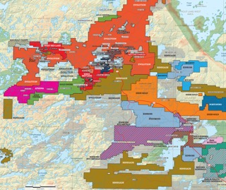
The Red Lake greenstone belt is in the western portion of the Uchi Subprovince of the Canadian Shield. The mineralization within the area is typical of Archean greenstone belt-hosted gold deposits. The Red Lake Greenstone Belt is approximately 50 km east-west by 75 km north-south,
Gold deposits in the district have been classified into three main categories: mafic volcanic-hosted, felsic intrusive-hosted and strata bound.
The Red Lake Greenstone Belt is an accumulation of Archean-age metavolcanics, meta-sedimentary and
intrusive rocks that record a volcanic history that spans 300 Ma, and is represented by seven volcano-sedimentary assemblages (Figure 3, Sanborn-Barrie et al., 2001)

The Balmer assemblage consists of tholeiitic and komatiitic flows and ultramafic intrusive rocks
intercalated with 2.98 – 2.96 billion year old (Ga) felsic volcanic, clastic, and chemical sedimentary rocks. It is host to the largest of the Red Lake District current and past-producing gold mines. Six successive, younger stratigraphic assemblages have been documented: (Walker, 2009)
References
Thomas, R.; 2009. Exploration activities of Rubicon Minerals Corporation on the Phoenix Gold Project, Red Lake Ontario; January 9 2009, p 25
Sanborn-Barrie, M., Skulski, T., and Parker, J., 2001. Three hundred million years of tectonic history recorded by the Red Lake greenstone belt, Ontario; Geological Survey of Canada, Current Research 2001-C19, 30 p.
Geology of the Birch-Uchi Area
The Birch‐Uchi Greenstone Belt is in the north‐central part of the Uchi Subprovince of the
Canadian Shield which consists of north trending volcanic and sedimentary rocks.
The greenstone belt is approximately 32 kilometres wide by 84 kilometres long enclosed in an envelope of granitic rocks.
The most favourable sites for potential gold mineralization are shear zones associated with major faults and deformation zones, particularly where alteration veining and disseminated sulfides are present, as well as areas within and marginal to the fine-grained high-level felsic intrusions.
These deposits are generally steeply dipping high grade gold deposits often located on flexures along lateral fault splays off principal crustal faults or breaks.
Both gold and base metals have been historically produced.


